
The Quiet Tide
Where to find Wales' most rewarding coastal stretches when the summer crowds finally begin to fade.

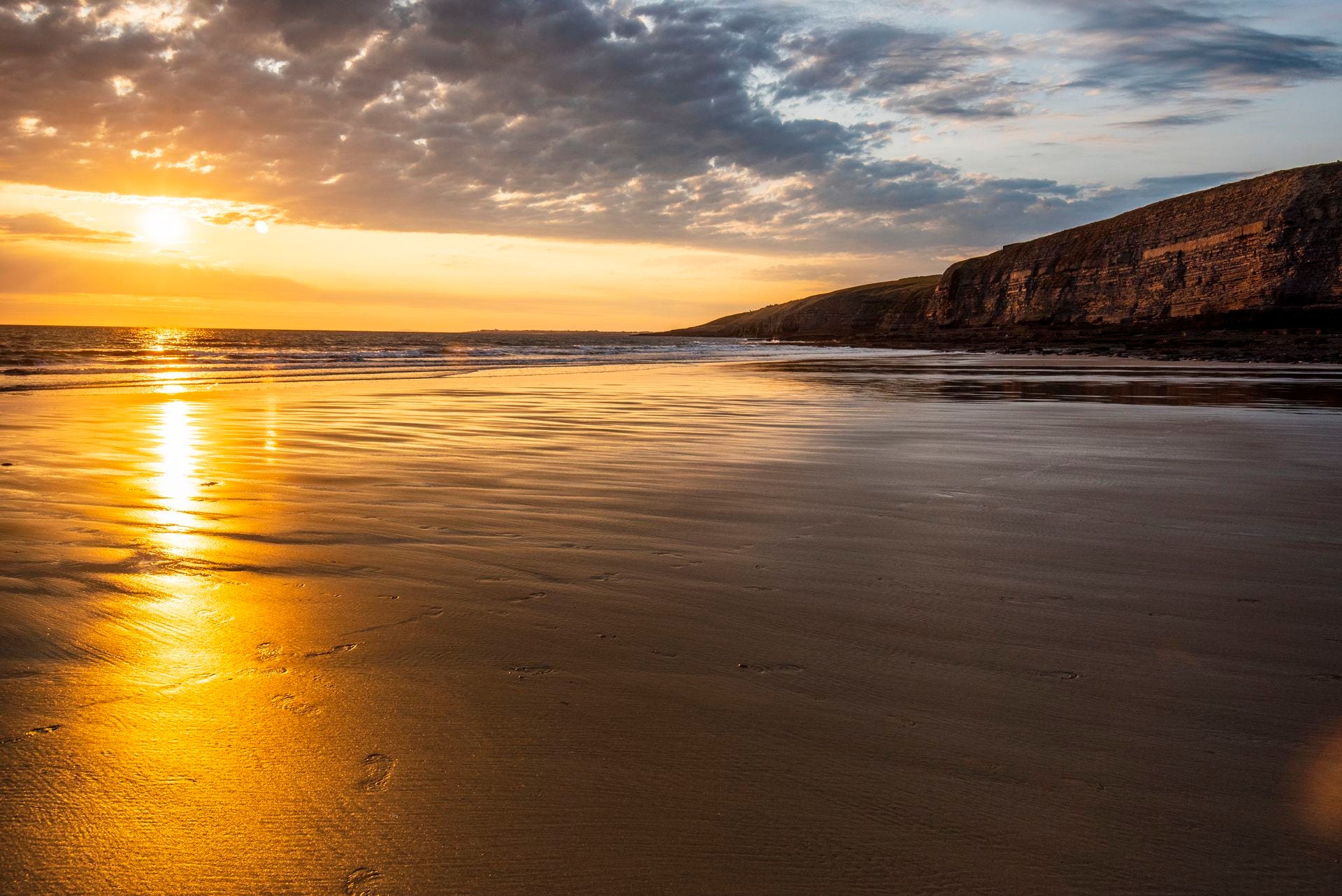
August and September are the months for the Welsh coast, but they are very different months. August is peak season. The school holidays are in full force, the car parks fill early, and the famous beaches are at their most crowded. September is something else entirely: the schools go back, the crowds thin, and the sea temperature has barely dropped.
The beaches in this guide are not the famous ones. Rhossili and Barafundle are well known and well covered. These five are the ones that reward the extra mile of single-track road, the twenty-minute walk, or the willingness to check the tide times before you leave. In August they are quieter than Tenby. In September they are quiet full stop.
PORTH OER (PORTHOR / WHISTLING SANDS)
Near Aberdaron, Llŷn Peninsula, Gwynedd
National Trust · LL53 8LH
The name requires a caveat before the description.
Porth Oer is known as Whistling Sands. The sand does make a sound underfoot, a high-pitched squeak, caused by the unusual shape and near-perfect spherical form of the quartz and silica grains, which rub together under pressure in a way that produces the noise. But it does not always happen. The sand needs to be dry, the conditions need to be right, and the sound is more of a squeak than a whistle. Some visitors hear it clearly. Others walk the full length of the beach and hear nothing.
The beach is worth visiting regardless.
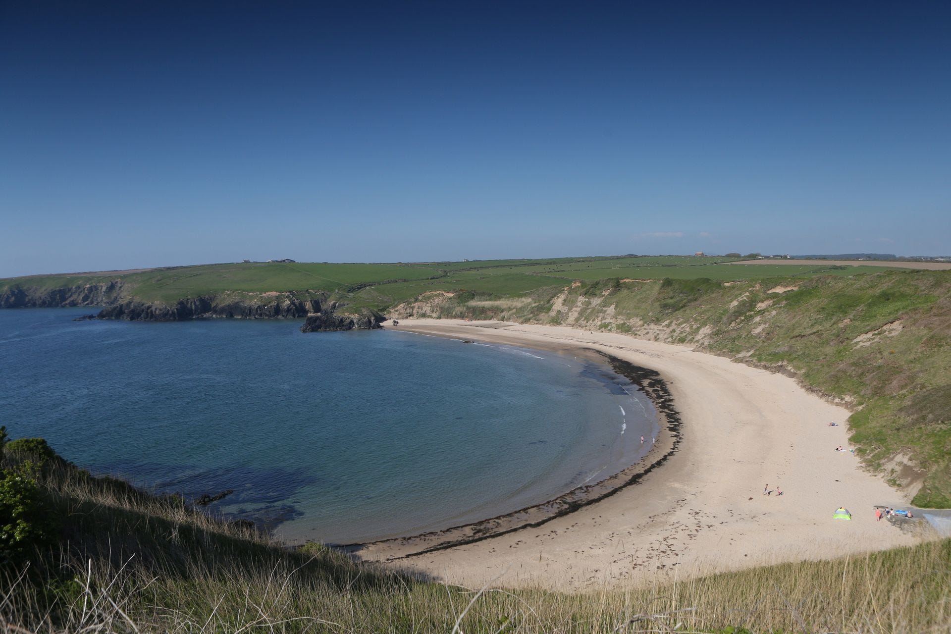
Porth Oer is a crescent of sand on the north coast of the Llŷn Peninsula, three miles north of Aberdaron, reached by a single-track lane that ends at a National Trust car park. The beach faces north-west into the Irish Sea. The cliffs above are backed by fields of grazing livestock. The Wales Coast Path runs past the headland in both directions, giving good cliff walking to the east and west. Seals appear offshore regularly. Dolphins are sighted in summer. Choughs, the red-billed crow of the Celtic nations, declining across much of its range nest in the cliffs around the Llŷn coast.
Porth Oer was once a working port, importing coal and lime and exporting farm produce. The small jetty ruins are still visible. A National Trust café operates from the top of the beach in summer.
There are submerged rocks in the water at each end of the bay. Swim in the central section. RNLI lifeguards are on duty July to September.
Practical: LL53 8LH. National Trust car park approximately 180 metres from the beach. Dogs restricted May to September. RNLI lifeguards July to September. Café open in summer.
ABERMAWR
Near Mathry, Sir Benfro (Pembrokeshire), SA62 5HJ
Pembrokeshire Coast National Park · Free access
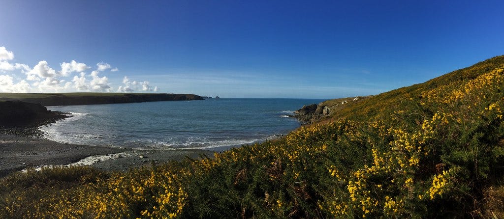
The reason Abermawr is little known is practical: it is only reachable on foot. The road from the A487 ends in a small lay-by with limited roadside parking. From there, a half-mile footpath drops through woodland to the beach. There are no facilities. No café, no shop, no toilets, no lifeguard. Dogs are allowed year-round.
What is there is a large shingle beach, pebbles rather than sand for most of its width, though the sand appears at low tide and it’s backed by a massive pebble bank, marsh and woodland. The Pembrokeshire Coast Path passes in both directions. The headlands are low and the sea is generally calmer here than on more exposed stretches of the north Pembrokeshire coast.
Two things make Abermawr worth knowing about specifically.
The first is the submerged forest. At low tide, the preserved stumps of ancient trees emerge from the sand at the base of the beach, the remains of a woodland that was alive approximately 8,000 years ago, when this stretch of coast was still inland. The trees were buried when sea levels rose after the last ice age. They are visible at low water and are one of the most extraordinary things you can walk across on a beach in Wales.
The second is Brunel. In the 1840s, Isambard Kingdom Brunel surveyed Abermawr as the intended western terminus for the South Wales Railway, planning a port here for passenger ships to Ireland and America. The route never came. The railway went to Fishguard instead. The large pebble bank that now protects the beach was created by a severe storm on 25 October 1859, the same storm that wrecked the Royal Charter off Anglesey and was recorded in detail by Charles Dickens. A former cable hut near the beach, now a private dwelling, was once the landward end of a submarine telegraph cable laid in 1873, connecting to Blackwater near Wexford in Ireland.
The short coastal walk east from Abermawr to Abercastle, a beautiful cove with a working harbour and a ruined 18th-century limekiln takes about thirty minutes and is one of the finer short walks on the north Pembrokeshire coast.
Practical: Limited roadside parking near SA62 5HJ. Half-mile footpath to the beach. No facilities. No lifeguard. Currents can be hazardous. Check tide times - the submerged forest is visible at low water only.
TRESAITH
Tresaith, Ceredigion, SA43 2JL
Blue Flag beach


Tresaith is a small village on the south Ceredigion coast, between Aberporth and Penbryn, on a bay roughly 250 metres wide. The beach has Blue Flag status. There is a pub, the Ship Inn, which has a terrace overlooking the beach, there is a small café and a shop within a short walk.
The reason to come specifically to Tresaith is the waterfall.
The River Saith flows through the valley above the village and, because a glacier blocked and redirected its course thousands of years ago, it no longer reaches the sea by an inland route. Instead it drops off the cliff at the northern end of the beach and falls directly onto the sand. The waterfall is visible from the beach at low tide; at high tide it is accessible by scrambling over rocks. It is, as far as most sources confirm, the only waterfall in Wales that falls directly onto a beach.
The name confirms the geography: Tresaith means Place of Seven, derived from the River Saith — saith being the Welsh word for seven. According to local legend, the landing point got its name when an ancient Irish king’s seven troublesome daughters were set adrift and came ashore here.
Seals and bottlenose dolphins are regularly sighted from the beach and from the coastal path to Penbryn to the north and Aberporth to the south. Cardigan Bay has a resident population of around 250 bottlenose dolphins and Tresaith sits within the designated Cardigan Bay Special Area of Conservation.
At low tide, the walk north from Tresaith along the foreshore to Penbryn beach, which is a National Trust beach backed by sand dunes and woodland takes about thirty minutes and is one of the finest short coastal walks in Ceredigion.
Practical: SA43 2JL. Car park above the beach - card payment now required, honesty box no longer accepted. Dogs restricted on the southern section of the beach from May to September. Lifeguards June to September. The Ship Inn serves food year-round.
YNYS LLANDDWYN (LLANDDWYN ISLAND)
Near Niwbwrch (Newborough), Ynys Môn (Anglesey), LL61 6SG
Natural Resources Wales · Part of Newborough Warren National Nature Reserve
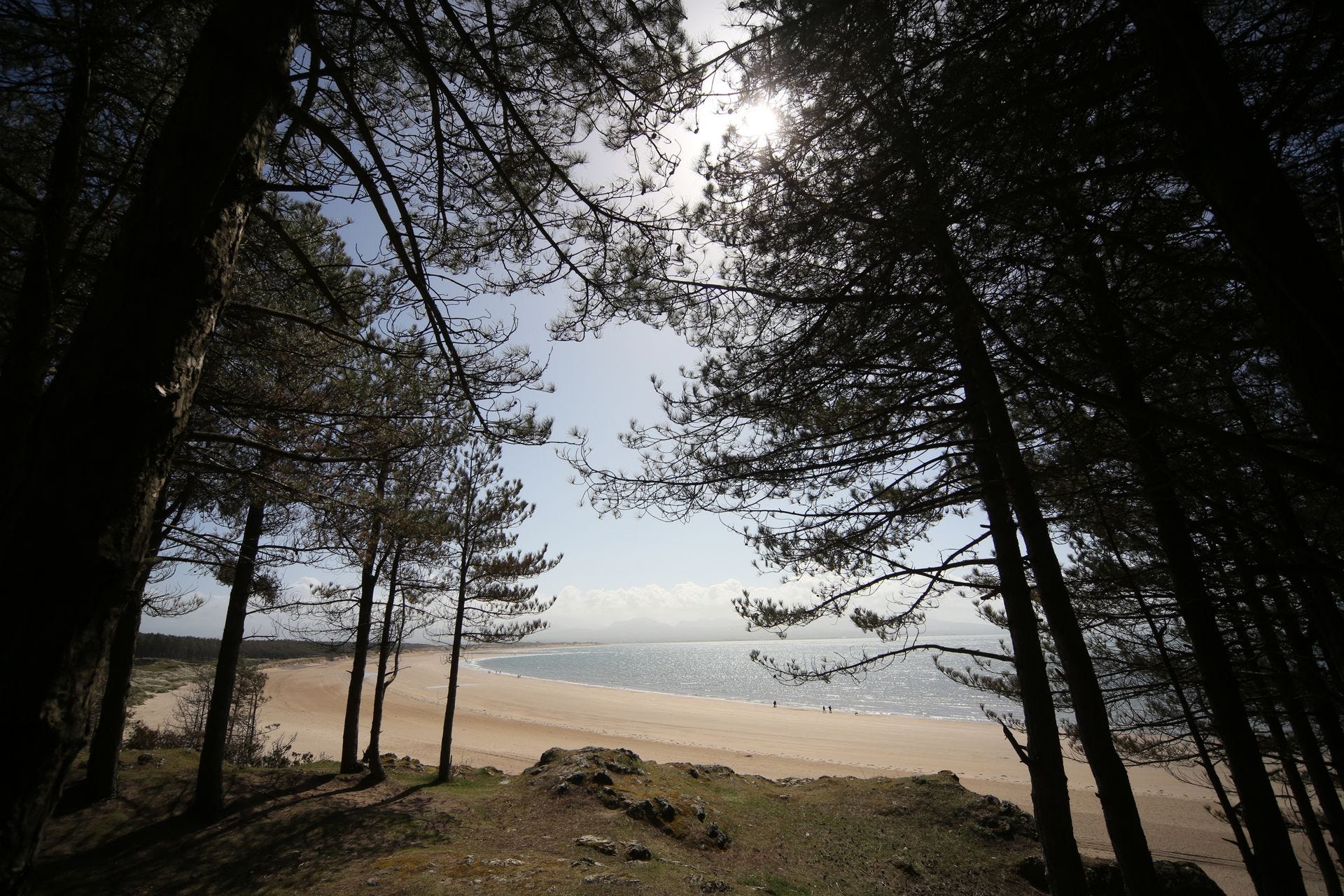
Llanddwyn is a tidal island and is accessible on foot at low tide, cut off at high tide, when a 200-metre stretch of water separates it from the mainland. The approach from the car park at Niwbwrch (Newborough) is along a mile of beach, through the edge of Newborough Forest, with the mountains of Eryri and the Llŷn Peninsula visible across the water the whole way.
On the island: the ruins of the medieval church of St Dwynwen, the patron saint of lovers in Welsh tradition, whose feast day on 25 January is the Welsh equivalent of Valentine’s Day. The church was built on the site of a 5th-century chapel; the remains of the walls and the holy well are still there. A large stone cross erected in 1897 marks the path. Two lighthouses — Tŵr Mawr, built in 1845, and the smaller Tŵr Bach stand at the island’s far point. A row of whitewashed pilot cottages, where the men who guided ships through the Menai Strait lived, faces the water. One contains a small exhibition on the island’s wildlife.
The views from the far end of the island take in the full length of the Llŷn Peninsula to the south, the mountains of Eryri to the east, and the open Irish Sea to the west. The island is part of a National Nature Reserve of international significance, and the geology of the island, pillow lava, jasper formations was included in 2022 on the International Union of Geological Sciences list of 100 geological heritage sites worldwide.
A critical practical note: leave the island at least two hours before high tide. The crossing can be swift and people are regularly caught by the tide. Check the times at tidetimes.org.uk before you go.
Practical: Park at Traeth Llanddwyn / Llanddwyn beach car park, LL61 6SG. ANPR entry system, pay on exit. Approximately one mile walk along the beach to the island. No facilities on the island. Free to access; forest parking fee applies. Check tide times before visiting.
BAE DWNRHEFN (DUNRAVEN BAY)
Southerndown, Bro Morgannwg (Vale of Glamorgan), CF32 0RP
Glamorgan Heritage Coast · Pay-and-display parking
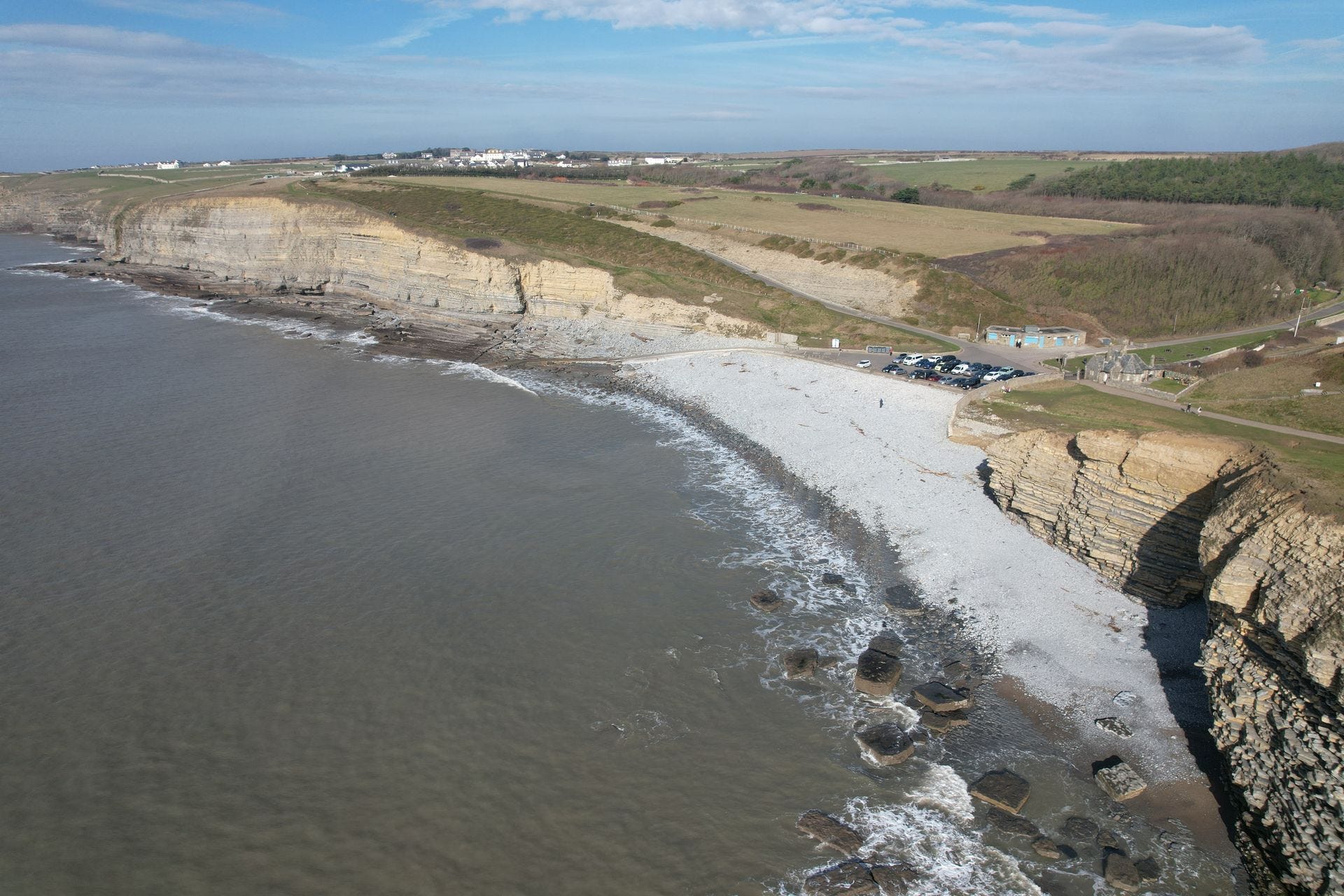
Dunraven Bay is the most southerly beach in this guide and the one that most people from outside South Wales have never heard of. It sits on the Glamorgan Heritage Coast — a 14-mile stretch of carboniferous limestone cliffs between Ogmore-by-Sea and St Athan in the Vale of Glamorgan, less than an hour from Cardiff.
The beach itself is wide, sandy at low tide and rocky at high, accessible from a pay-and-display car park at Southerndown next to the Heritage Coast Centre. The Bristol Channel tides are among the largest in the world and the beach disappears substantially at high water. Check tide times before making a long drive.
The headland immediately south of the beach is the site of an Iron Age hillfort. Dunraven Bay and its surrounding cliffs have been occupied since at least the Iron Age, with the elevated clifftop position believed to have been used as a trading post. The Romans later built a fort here. The castellated mansion known as Dunraven Castle, which dominated the headland until it was demolished in 1963, is gone, but the walled gardens that surrounded it have been restored and are open to visit from the car park.
The cliffs of the Heritage Coast between Nash Point and Dunraven are among the most geologically varied in Wales. The wave-cut platform at beach level is Carboniferous limestone, formed when this area lay beneath a warm shallow sea around 350 million years ago. The spectacular layered cliffs above are predominantly Jurassic rock, specifically the Blue Lias and Sutton Stone formations, around 200 million years old and it is these that produce the ammonites and bivalve fossils that collectors come for at low tide.
The walk west along the Heritage Coast to Nash Point, four miles, past Cwm Nash and Cwm Mawr is one of the finest coastal walks in South Wales and almost unknown outside the Vale of Glamorgan.
Practical: CF32 0RP. Pay-and-display car park at Southerndown. Heritage Coast Centre adjacent. Seasonal RNLI lifeguards late May to September (10am to 6pm). Check Bristol Channel tide times as the tidal range is among the highest in the world. Fossil hunting permitted on loose rocks at beach level only.
THE SEASON
August and September are different months on the Welsh coast and it is worth being honest about that.
August is peak season. The sea is at its warmest, Pembrokeshire peaks on average at 16 to 17°C, Ceredigion slightly cooler, the Bristol Channel at Dunraven warmer than most people expect. But the school holidays mean the car parks fill early and the accessible beaches are busy. For August, the practical advice for all five beaches in this guide is the same: arrive before 10am, check tide times the night before, and consider a weekday over a weekend.
September is the sweet spot. Schools are back, the car parks empty out, and the water temperature has barely changed from August. Abermawr and Dunraven Bay in particular come into their own in September — quiet, accessible, the light different from July in a way that is hard to describe and straightforward to experience.
All five are worth the journey in either month.
QUICK REFERENCE
Porth Oer (Whistling Sands): LL53 8LH · National Trust · Car park 180m · RNLI lifeguards Jul–Sep · Dogs restricted May–Sep · Café in summer
Abermawr: SA62 5HJ · Free · Half-mile footpath · No facilities · No lifeguard · Submerged forest at low tide · Dogs year-round
Tresaith: SA43 2JL · Blue Flag · Lifeguards Jun–Sep · Car park (card payment) · The Ship Inn on site · Dogs restricted southern section May–Sep
Ynys Llanddwyn: LL61 6SG · ANPR car park (pay on exit) · 1 mile walk to island · No island facilities · Leave 2 hours before high tide
Bae Dwnrhefn (Dunraven Bay): CF32 0RP · Pay-and-display parking · Heritage Coast Centre adjacent · Seasonal RNLI lifeguards late May–Sep · Check Bristol Channel tide times
Hwyl am y tro.
Nick — Discover Wales · wales.org